After years of successful research and applications in the area of geospatial information for humanitarian aid and emergency response, UNOSAT has acquired considerable technological and inter-agency knowledge in this complex and often misunderstood activity field.
With a service active 24/7 and available to the entire humanitarian community since 2003, UNOSAT has supported humanitarian agencies and programmes in some 200 disaster response and complex emergency operations worldwide, deploying to the field each time it was requested and working in close cooperation with emerging in-field mapping realities like MapAction, CartONG, iMMAP and others.
The research and study work underpinning these successes have taken UNOSAT in contact with other large entities and in particular with Google. After working in close consultation and event cooperating on several “live cases”, Google and UNOSAT have undertaken to rationalise and plan their cooperation. In November last year, wishing to focus on some vital research and applications areas, Google and UNOSAT elaborated a cooperation plan including the study of innovative applications of MapMaker, which UNOSAT was able to successfully test in a full range of real crisis situations.
The future of the Google-UNOSAT cooperation looks bright as the two entities are engaging in 2010 in additional innovation with a view to bringing more edge and efficiency to an area developing particularly fast but not always in adherence with the requirements of the user community. The latter is of paramount importance to UNOSAT and has been at the basis of all the Team’s work since its inception. The importance of this strong link with the user community was most recently highlighted by Sir John Holmes, United Nations Under-Secretary-General for Humanitarian Affairs and Emergency Relief Coordinator, in a letter underlining “the contribution made by UNOSAT to humanitarian responses (...) and its efforts to coordinate the academic and operational partners involved in the production of satellite-derived geographic information”.


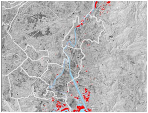
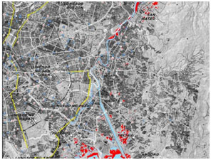
Detail from rapid mapping product over Philippines without (left) and with (right) MapMaker data.

