
UNOSAT and the Space Charter Mobilize to Watch Typhoon Hagupit
8 December 2014, Geneva, Switzerland - As typhoon Hagupit (also known as Ruby) headed for the Philippines, UNOSAT requested the triggering of the International Charter Space and Major Disasters to obtain vital optical and satellite radar data to generate information at the request of OCHA and UNDP Crisis Response Unit.
Ahead of the typhoon's landfall the Filipino authorities had evacuated nearly 1 million people, also a sign of the deadly past experience from typhoon Haiyan of last year. A large part of the population affected by this new event was still recovering from the disastrous consequences of Haiyan. To date no casualties have been reported thanks to the preventive measures and the immediate response deployed by the government, however an estimated 1 million people are in 687 evacuation centres and tens of thousands more are in need of relief. The damage to infrastructures and houses is still being determined.
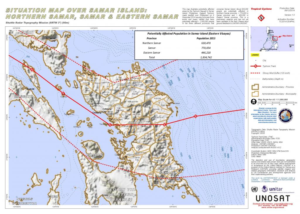
UNOSAT rapid mapping helps in this situation by providing geographical information on the area affected by the typhoon. One of the maps released this week shows the path of Hagupit and the buffer zone that was exposed to winds of more than 120 Km/h. UNOSAT says that the disaster area is home to over 1.8 million people.
Radar satellite data provided by the Space Charter has been used to generate information on residual water left in the wake of massive rainfall due to the typhoon. This information is particularly useful in this type of disaster where the damage in remote areas is difficult to estimate rapidly
Image 1: UNOSAT maps showing standing waters after the passage of the typhoon
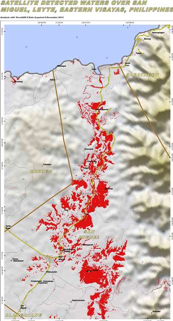
Image 2: the rain accumulation in the wake of Hagupit
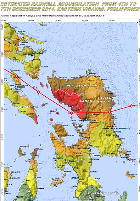
Image 3: the path of the typhoon as it crossed the Philippines including the population living in the area and the buffer zone struck by winds of more than 120 Km/h
Related links
UNOSAT maps on the Philippines