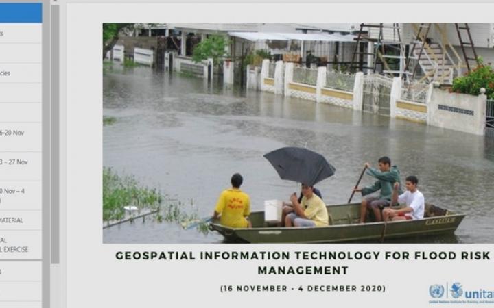
20 January 2021, Geneva, Switzerland – UNOSAT delivered a four week moderated e-learning course under the framework “Strengthening Women’s Disaster Management Capacities in Guyana and Dominica”, a project funded by the Government of Japan and led by UNDP Guyana. The e-learning event is part of the capacity development activities planned under the second component of the “Development of Guyana’s National Flood Early Warning System (NFEWS)" initiative.
Disasters such as floods, hurricanes, and droughts, represent a recurring threat for the development of Guyana’s agricultural sector, affecting local communities and the fight to reduce poverty and economic inequalities. In order to strengthen Guyana’s Climate resilience, UNOSAT developed and delivered an e-learning course on Flood Risk Management for key national stakeholders to enhance their technical skills and knowledge. This capacity development activity is part of the project Strengthening Women’s Disaster Management Capacities in Guyana and Dominica, under the initiative “Development of Guyana’s National Flood Early Warning System (NFEWS)“. The course represents the second component of the project, after the nation-wide flood forecasting system was developed as the first component to support Ministry of Agriculture, Hydrometeorological Service’s flood forecasting daily practices and decision making in flood preparedness and response.
After an extensive training needs assessment, UNOSAT has developed activities targeting stakeholder groups who are working with disaster risk reduction activities across different governmental institutions in Guyana. In order to adapt to the COVID-19 prevention measures and ensure that these activities are delivered in a safe and yet efficient manner, the training was delivered in the form of an e-learning moderated course.
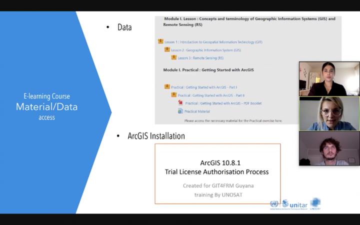
The training on Geospatial Information Technologies (GIT) Applications for Flood Risk Management (GIT4FRM) was divided into 5 modules composed of several sessions and quick quizzes. The content was presented through theoretical concepts and terminologies, case study examples, particular tutorial videos (demos), and additional reading material. For the self-study, selected reading material and a tailor-made GIS booklet were available for all participants to practice acquired skills through step-by-step GIS tutorials.
“Being familiar with GIS, I saw the GIT for Flood Risk Management training as a solid data and application resource. These resources/references provided, along with the understanding of their use cases will be quite beneficial to many individuals and agencies in Guyana, as limited relevant data is often cited as limitation.” Joel Trotman, Land Use Planner, Guyana Lands and Surveys Commission
For this online course 26 participants were nominated from 8 national institutions: Office of Climate Change, Hydrometeorological Service, Civil Defence Commission, National Drainage and Irrigation Authority, Guyana Livestock Development Authority, National Agricultural Research and Extension institute, Guyana Lands and Surveys Commission and University of Guyana. The participants were introduced to basic concepts, terminology and interlinkages related to GIT, Geographic Information Systems (GIS), Remote Sensing, and Disaster Risk Reduction with a focus on Flood Risk Management. The participants were also provided with hands-on GIS exercises for flood hazard and risk assessment. To encourage participants’ engagement and get instant feedback on the course, live chat sessions were also organized during the course by UNOSAT experts.
"The GIT4FRM training was well designed, it allowed the participants to grasp the most intrinsic elements of several complicated areas - geospatial information and analyses, flood risk management and the GFT tool without overwhelming the user. I was able to grasp all of the concepts and look forward to using this tool here in Guyana as we combat climate change related flooding at an ever-increasing frequency. It is my hope that this training will enable stakeholders to fully utilise the products of Guyana's National Flood Early Warning System in time to come." Crystal Conway, GIS Engineer, National Drainage & Irrigation Authority, Ministry of Agriculture (Guyana)
The online course started on 16 November with a live webinar opening session and for a duration of 4 weeks, instead of the 3 originally planned. This, in addition to the blended learning approach chosen (asynchronous learning, downloadable content and access to the platform 24/7), provided the participants with high flexibility to attend and finalize the training successfully. This translated into high satisfaction amongst the participants after completion of the training. Indeed, an overwhelming majority of the participants found the content useful and relevant to their jobs.
The course evaluation results revealed a solid appreciation of the training, and that the content provided participants with a good balance of introductory topics for people new to this field and continuation in learning for ones who were already familiar with GIT and flood risk management.
According to the United Nations Office for Disaster Risk Reduction (UNDRR), women are still too often absent from the development of DRR strategies and decision-making processes. Therefore, achieving gender parity in trainings is a common challenge. However, it is with great satisfaction that UNOSAT and UNDP Guyana welcomed a female majority of 56% of the participants.
"I think this training is relevant and useful because it has given me the opportunity to develop additional skills and knowledge in GIS and GIT with its applications in Disaster Risk Reduction and Flood Risk Management. The knowledge gained will definitely assist us locally in the implementation of Guyana’s National Flood Early Warning System (NFEWS).” Haymawattie Danny, Telecommunication Engineer, Hydromet
During the preparation of the objective self-assessment, it was taken into account that women tend to underestimate their abilities, often attributing their success externally or to more effort than men. The survey was filled by 65% female and 35% male and there was no significant difference noticed in the self-assessment done by male and female participants overall. Considering the small size of the sample and the extent of the objective assessment, it is not possible to draw a definitive conclusion regarding female participants self-perception regarding their learning achievements. Nonetheless, the objective assessment has proved to be an important tool for gender sensitive learning evaluation.
Further capacity development activities implementation is seen in the second training delivery on operational flood forecasting practices. This training is tailored for the Ministry of Agriculture, Hydrometeorological Service’s officers who are going to operate daily with Guyana NFEWS.
For more information, please contact UNOSAT at unosat@unitar.org or UNDP Guyana at registry.gy@undp.org.


