

24 September 2013, Geneva, Switzerland - During an information session for government delegates to the United Nations organised by OCHA at the Palais des Nations, UNOSAT was unanimously commended for its work in providing the humanitarian community at large with satellite imagery analysis and near-real time rapid mapping.
The meeting was called by the UN Office for the Coordination of Humanitarian Affairs specifically to inform UN member states about the UNOSAT Humanitarian Rapid Mapping Service, which has turned 10 years old this year. In opening the meeting, Rashid Khalikov, Director of OCHA Geneva said “UNOSAT does good work and I could see for myself from the field in Pakistan and Libya how useful their analyses are”.
 The collaboration between UNOSAT and OCHA dates back to the very beginning of UNOSAT in 2000. The relationship then grew into a partnership with the increase of the value of geographic information in the area of emergency response. Satellite imagery analysis is a specialised high-end part of the geographic information needed to address humanitarian relief coordination today. OCHA accounts for about 35% of all UNOSAT humanitarian mapping activations. Each year the UNOSAT team supports with rapid mapping an average of 35 to 40 emergencies worldwide.
“Our job in the humanitarian field is to respond to requests from OCHA and other agencies like UNICEF, UNHCR, WFP and others” says Einar Bjorgo, the Manager of UNOSAT. Since 2006 UNOSAT has responded to 100% of the requests emanating by humanitarian agencies, thanks to the support received from some member states and because of economies of scale among UNOSAT mapping services.
Satellite analysis is today a central element of objective situational awareness in humanitarian crises and geographic information systems (GIS) are becoming a leading standard for joint needs assessments. UNOSAT experts have also started involving volunteer mappers and ordinary citizens in a new generation of geographic products that integrate data and photos from people living in affected areas.
 “OCHA and UNITAR have created this partnership so that the whole humanitarian community can benefit from UNOSAT mapping. We have heard from many agencies and also governments how satellite analysis and rapid mapping has helped take the right decisions and eventually save lives. We want to thank our donors and invite others to join them in supporting what UNOSAT does for humanitarians” said Sally Fegan-Wyles, Executive Director of UNITAR.
The future of rapid mapping is bright, according to the UNOSAT Manager: “While ten years ago we had to remind humanitarians of the availability and benefits of rapid mapping, UNOSAT support is now considered as indispensable and an integral part of any major humanitarian operation”.
UNOSAT management is appealing to donors to support the 2014-2016 implementation plan. For more information: unosat@unitar.org
Watch the new UNOSAT video here to better understand Humanitarian Rapid Mapping.
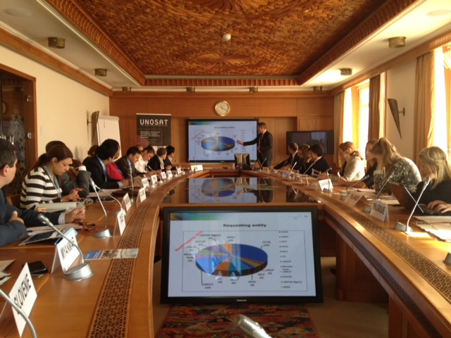
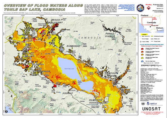
Images: Above, delegates from UN member states listen as UNOSAT Manager presents the results of Rapid Mapping in 2012. Below, a typical UNOSAT map capturing the situation on the ground after a natural disaster.