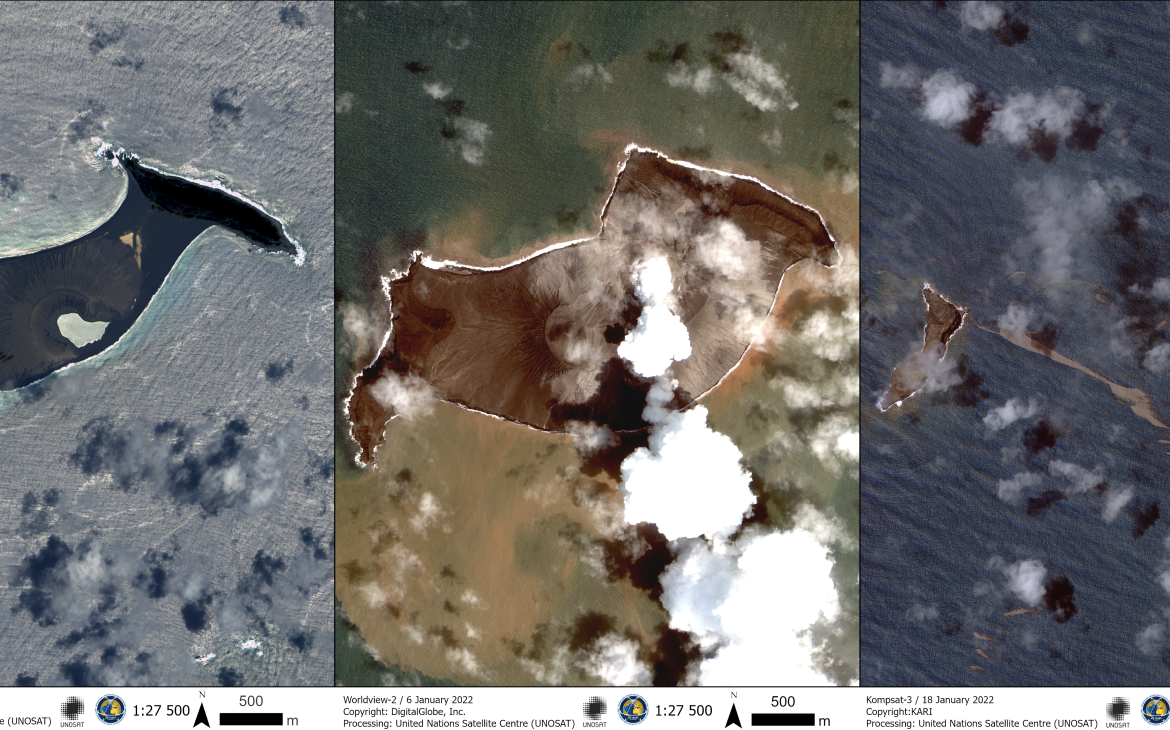
18 January 2022, Geneva, Switzerland - On Saturday 15th January, the ongoing volcanic eruption of Hunga Tonga-Hunga Ha’apai triggered a tsunami across the Pacific.
The UNOCHA Regional Office for Asia and the Pacific swiftly contacted the United Nations Satellite Centre (UNOSAT) to request the activation of its Emergency Mapping service over Tonga. UNOSAT analysts started right away collecting relevant data and triggered the International Charter: Space and Major Disasters to collect satellite images over the area.
The first analyses published show initial assessment of damage to roads and buildings on nearby inhabited islands, and before-after images of the Hunga Tonga-Hunga Ha’apai volcano, with its caldera collapsed and most of the island now submerged.
All the analysis results can be found at this link, including the dedicated live map. The latest updates are also shared on Twitter.


