

16 November 2011, Bangkok, Thailand
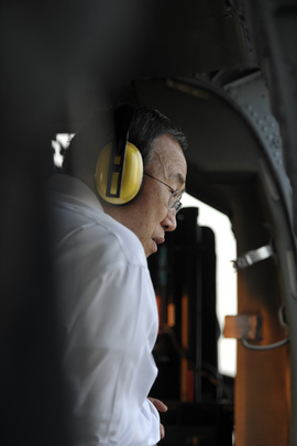
The United Nations Secretary-General Ban Ki-moon was concerned over the impact of the recent floods in Thailand after flying by helicopter over Bangkok. “I am deeply saddened and humbled by what I have seen by helicopter while travelling over these affected areas,” he told reporters in the Thai capital, according to the UN News Centre.
The night before Mr. Ban’s arrival, UNOSAT had been contacted by the OCHA Regional Office with an urgent request for a geospatial overview of the floods for the Office of the UN Resident Coordinator in Thailand. The Office was preparing the helicopter flyover together with the Thai government. Einar Bjorgo of UNOSAT says “they were in a hurry to prepare a briefing for the Secretary-General. They realised that a good map showing how the flooding situation had evolved since its beginning simply did not exist. The person contacting us from the Information Management section of the OCHA Regional Office in Bangkok said that the challenge was that no one seemed to be doing any mapping of the Thai floods since mid-October…”. UNOSAT produced the requested map within the same afternoon and sent it to Bangkok to be included in the briefing and printed for other uses during the Secretary-general’s visit, which included a meeting with Thailand’s Prime Minister Yingluck Shinawatra.
The map produced by UNOSAT is based on a time series analysis of the dramatic southward progression of flood waters from the central provinces of Thailand towards the capital city of Bangkok, based on satellite data recorded from mid-August to 14 November 2011. Einar Bjorgo recalls “the OCHA Regional Office thought this was a real challenge for us because they knew that there were no data published by other entities from September and later on. But the fact is that we keep supporting the humanitarian and UN colleagues long after the spot lights are turned off, even when we are activated on other subsequent emergencies elsewhere in the world. We simply did our job, a little rushed perhaps, but we are used to this as well”.
The map was also used as a reference during the fly-over of the areas most affected by the floods. Francesco Pisano, the Manager of UNOSAT, explains “this type of situation is not unusual for us: very often at the beginning of natural disasters there is a peak of interest and a number of actors make lots of different maps. After the initial surge of mapping efforts done under the umbrella of emergency response, the attention wanes and there is simply no one around to heed an urgent request as specific as this one. I think we have made clear over the years that standard pre-determined product types are simply not suited for humanitarian situations, although they can be extremely useful in other types of emergency situations”. The map combins various layers of informartion derived from a wide range of satelltie images and radar data acquired by UNOSAT over the long time span of teh flood emergency, which begun in August 2011. Satellite data used include MODIS (NASA), very-high resolution imagery from DigitalGlobe, and near real time radar data provided by UNOSAT Partner KSAT of Norway within the framework of GEO-PICTURES, a research project funded by the Euroepan Commission of which UNOSAT is part as well.
UNOSAT has consistently argued that in some cases geospatial information can indeed make a difference and bring about a distinctive advantage in the field, while in other cases this is clearly not true. Engaging to support the users with satellite derived information is part of UNITAR work within its Research Department and has followed a strategy parallel to but different from the promotion of satellite technology per se and space based solutions in general.
In the case of the floods in Thailand, the feedback from the UN colleagues in the field is clear: “UNOSAT maps, data, and products have been very well received here in Thailand and have been very helpful in understanding the scope and scale of this emergency. Well done! (as usual)”.
Photo: Secretary-general Ban Ki-moon aboard the helicopter flying over affected areas in Thailand on 16 November (courtesy UN Press Centre)