

5 May 2012, Geneva, Switzerland - The selected training offer provided by UNOSAT has known an unprecedented success in the last two years. More than 30 knowledge sharing activities and training courses have been designed and delivered by UNOSAT by end 2011, reaching some 600 active professionals in more than 40 beneficiary countries worldwide. These figures reveal a different facet of UNOSAT, an applied Research Programme mainly dedicated to operational work.
UNOSAT training has become rapidly popular because it is based on the operational experience gained by UNOSAT in over ten years of work in crisis response and satellite a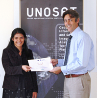 nalysis. Over 40 countries have already benefited of standard and tailored courses.
UNOSAT courses are designed for national experts and international organizations’ staff. All courses are based on modules designed in-house and based on the practical experience accumulated at UNOSAT while applying satellite technology and GIS solutions in concrete situations ranging from disaster response to complex emergencies, and from humanitarian assistance to human security and human rights.
This experience‐based training method is reinforced by results coming from applied research and additional certified training material that cover also strategic territorial planning and local development planning, stretching to disaster risk reduction and adaptation to climate change.
Teaching methods are centred on sharing practical knowledge and systematise theoretical notions. The focus is on active learning and hands-on experience through computer‐assisted exercises based on real case scenarios derived from recent disasters and conflicts. This is combined with theory lectures, round tables, visits and field simulations.
The UNOSAT portfolio of training ranges from 1-day generic workshops to intensive training courses (3 days/ 1 week/ 2 weeks/ 3 weeks), and medium‐long term capacity development programmes tailored according to needs and delivered either in‐country or at UNOSAT premises in Geneva.
The current UNOSAT training and capacity building portfolio inlcudes:
- Master level course: Use of satellite imagery for emergency response mapping
- Basic and advanced courses in the use of satellite imagery for human security, emergency response mapping and strategic territorial planning;
- In-country capacity building programmes to strengthen local capacities in the use of satellite imagery for disaster risk management and territorial planning;
- Introductory e-learning training course in the area of geospatial information technology;
- Workshops and information sharing sessions on the use of geospatial information technology for decision makers.
All courses are updated each year with new modules. Additional courses are planned for 2012-2013. Scheduled events are announced on the training pages of the UNITAR website. For tailored and in-country activities, please contact the UNOSAT Team at unosat<at>unitar.org.
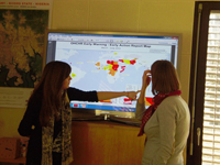
Photos: UNOSAT (Certificate award; Human Rights Training)