2 October 2020, Geneva, Switzerland – Last week, UNOSAT delivered the Advanced Training on Earth Observation (EO) and Geospatial Information Technology (GIT) for Climate Resilience in Fiji and Vanuatu. This week-long training was delivered as part of the capacity development activities of the CommonSensing project* that aims to improve climate resilience in the Pacific small island states. Adjusting to the COVID-19 preventive measurements in partner countries, UNOSAT adopted a blended-type of delivery method.
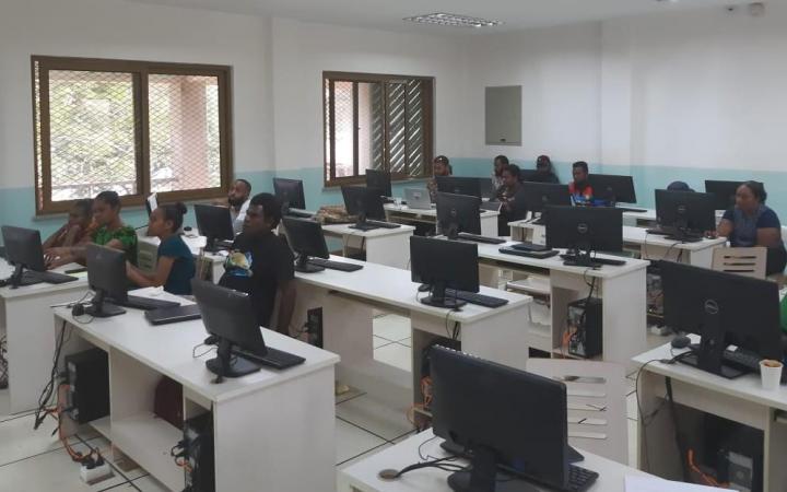
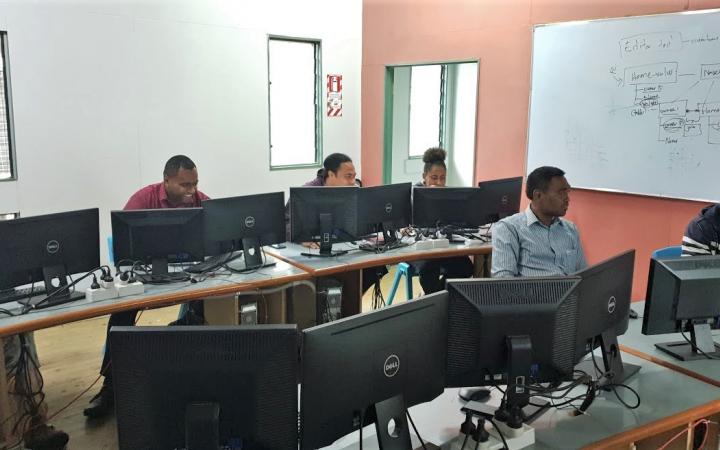
The Advanced Training on EO and GIT for Climate Resilience ran from 21st to 25th September 2020 in the GIS labs of the University of the South Pacific (USP) in Port Vila, Vanuatu, and Suva, in Fiji. This training build on the first sessions delivered in November 2019, which focused on developing the knowledge on EO and GIT in beneficiary countries by introducing key concepts and terminologies relating to Geographic Information System (GIS) and remote sensing.
The advanced training aimed to further develop technical capacity of both national governments and academia, to use GIS and Remoted Sensing to improve disaster risk management, climate change adaptation, and food security. A total of 43 representatives from national Ministries and academia in Fiji and Vanuatu were able to enhance their skills through participatory activities such as population exposure analysis and building damage assessments for tropical cyclones, geodatabase management, land cover classification, and land cover change detection.
“The blended approach adopted was very effective in this instance. The concepts covered relevant scenarios with local data to address common applications of GIT and Remote Sensing across the sectors. Combining the video lectures, tutorial demonstrations, online classroom activities, with a very clear booklet supported by in-classroom hands-on support resulted in effective knowledge transfer that users found refreshingly helpful. Sentiments shared by majority of the participants is that this was commendably amongst the best technical trainings they have attended.” – Lebaiatelaite Gaunavinaka, In-country expert for Fiji, UNOSAT.
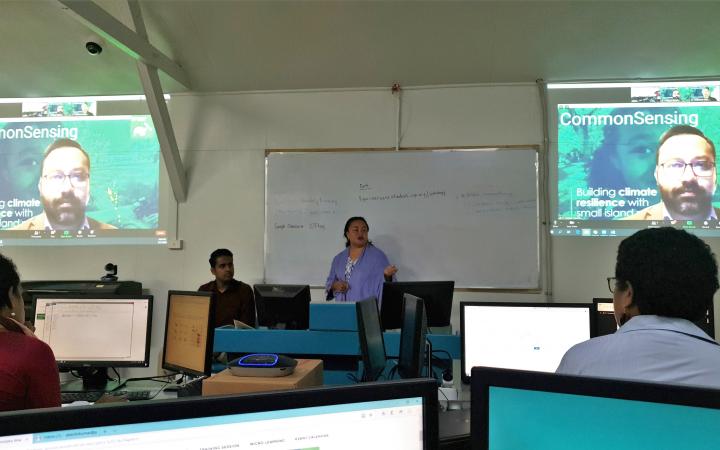
Since UNOSAT’s training experts could not deliver the training in person due to the current travel restrictions, the sessions were pre-recorded, including the welcoming remarks by UNOSAT’s manager and Director of the CommonSensing project, Einar Bjorgo. The sessions were facilitated from UNITAR’s regional offices in Bangkok, Thailand, with the support of the in-country experts present in the GIS lab at the USP campus. The participants were able to interact with the facilitators through video-conference, chats and discussion boards, for further guidance. This blended format, mixing webinar-like sessions and live interactions, was highly efficient to meet the learning objectives. It also allowed the delivery team to respect the covid-19 preventive measures in the classrooms. In both countries, USP’s GIS labs were at 50% capacity and hand sanitizers were made available for participants, following partner countries’ current regulations.
“The outline of the course was very interesting. I am able learn a broader understanding on spatial analysis. (...) Now that I am familiar with the tools, I can utilize the skills to produce an analysis on spatial disaster rapid assessments.” Mr. Neil Livingstone Malosu, Vanuatu Meteorological & Geo-Hazards Department (VMGD), Ministry of Climage Change in Vanuatu, and participant of the Vanuatu training.
“This week was a short and intense week of learning, I have learned a lot and the practical use of local data was a great idea because we can relate to the data. I will share my knowledge on Remote sensing that I have acquired with my coworkers, especially on the change detection, image analysis and classification.” - Tevita Nasova Vakataga, Geospatial Officer, Air Survey and Remote Sensing Unit, Ministry of Lands & Mineral Resources of Fiji, and participant of the Fiji training.
In Vanuatu, Mrs. Karen Bell, UK High Commissioner to Vanuatu, Mrs. Esline Garae Bule, Director General, Ministry of Climate Change, Dr. Krishna Kotra, Science Programme Coordinator, and Mr. Ruben Markward, Director Emalus Campus, took part of the opening ceremony.
In Fiji, the participants were welcomed by Dr. Nick Rollings, Associate Professor, School of Geography, Earth Science and Environment, USP and Mr. Vineil Narayan, Acting Head of Climate Change & International Cooperation Division, Ministry of Economy of Fiji.
The same training is planned to be delivered in the Solomon Islands in the coming weeks. To more about the CommonSensing project, please visit www.commonsensing.org.uk or follow @EOCommonSensing.
*The CommonSensing project, through a consortium of international partners led by UNOSAT, is an innovative international project that aims to support and build climate resilience and enhance decision making through the use of satellite remote sensing technology for Fiji, Solomon Islands and Vanuatu. This project is financed by UK Space Agency, through their International Partnership Programme (IPP), and part of the Global Challenges Research Fund (GCRF). UNOSAT has been delivering capacity developing activities on satellite remote sensing applications to support the Governments of Fiji, the Solomon Islands, and Vanuatu in their efforts to build climate resilience.


